The prevailing wind is from the South West. This is an area of high rainfall (over 1,800 mm/year) with a 'micro-climate' determined by its position between mountains.
Current weather data is available for the upper Senni Valley, 1 mile south of Heol Senni, from a Davis 'Vantage Vue' weather station which is maintained by the Webmaster.
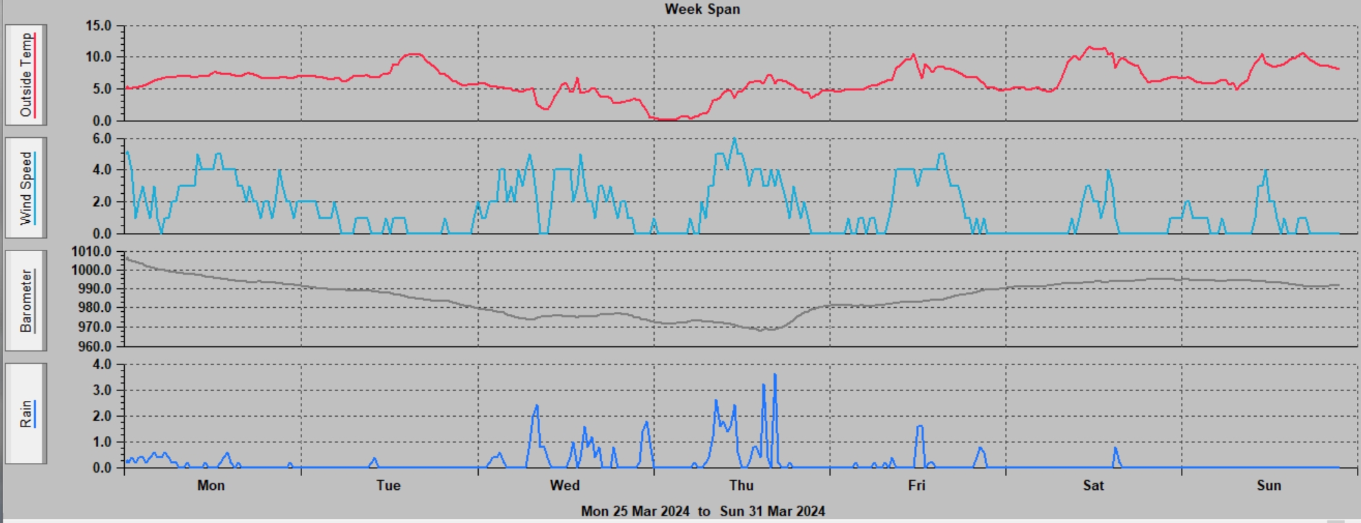
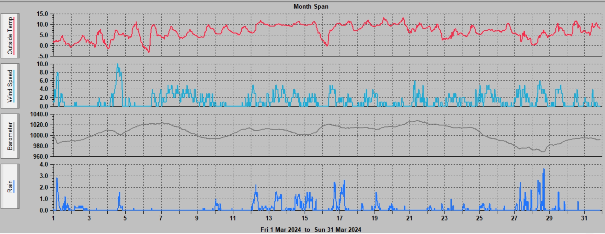
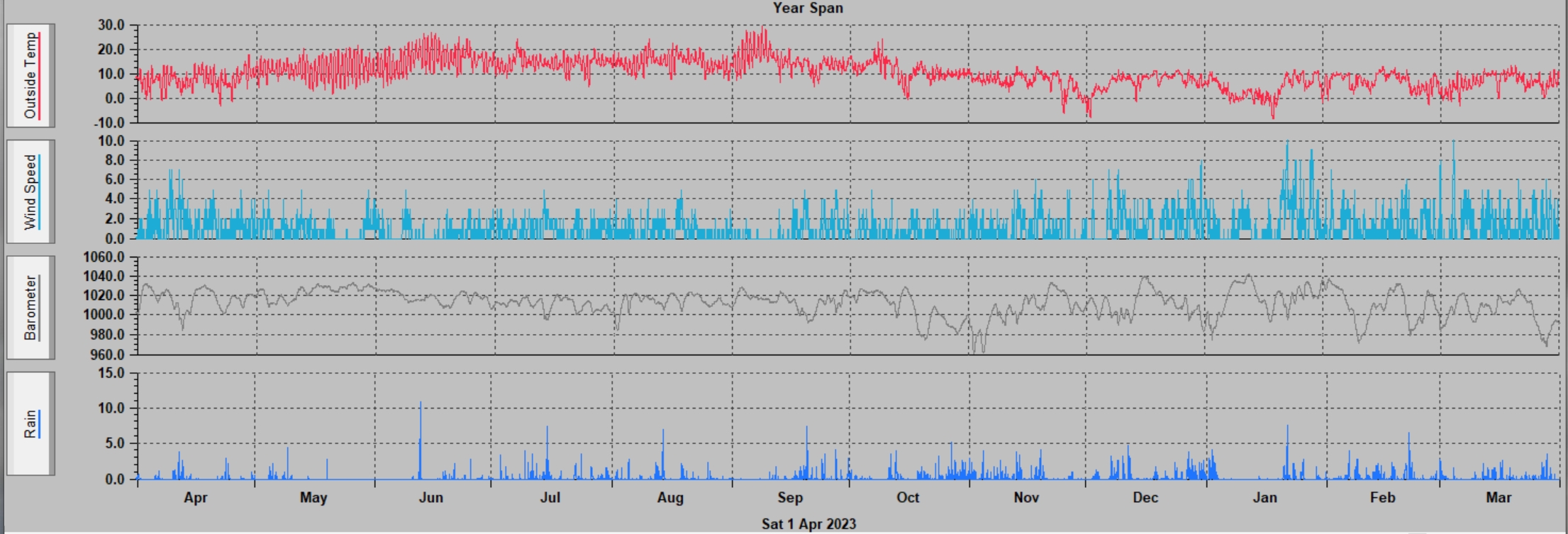
Graphs of the weather in Senni are also available for the previous week, the previous month, and the previous year.
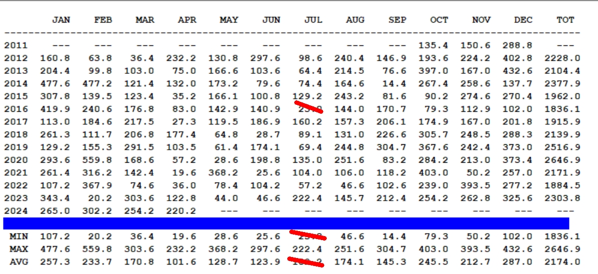
The annual rainfall here is about 2,190 mm, making it one of the wettest parts of the U.K which has an average of 1,163 mm/year.
Global warming appears to be affecting the weather here, with extremes. These are likely to increase as atmospheric greenhouse gases are still increasing. The mean yearly temperature, trend and anomaly for 1979 - 2023 for this area is shown at meteoblue. There has been no change in yearly precipitation here since 1979.
The wettest month was February 2020 with 559.4mm rain, over twice the average for the month. 2020 was the wettest year. On 20/09/2018, 3.75" rain fell in 12 hours. 250 mm (9.9") rain fell overnight 12 - 13/10/2018 during Storm Callum, the heaviest rainstorm many people here can recall. May 2021 was very wet after April 2021 that was exceptionally dry.
The driest month was September 2014, with 14.4 mm of rain, only 10% of the average for September. February 2023 was also very low, 20.2 mm. April 2015 and 2917, October 2016 and May - July 2018 and April 2021 were also dry months.
The hottest month was July 2024. It was about 1.2°C (2.1°F) hotter than average across the globe, according to data from the National Oceanic and Atmospheric Administration (Noaa)
The hottest day was 18 July 2022: 33.7°C at 15:31. On 19/07/2022, Coningsby had the hottest day ever recorded in the UK: 40.3°C.
Summary of monthly and annual rainfall up to 31/08/2025, (mm rain): (10 days of data for July 2016 are missing)
See also Weather forecasts & the current and previous Senni river level at Pont Hen Hafod, half way between Heol Senni and Defynnog. Natural Resources Wales flood warnings, updated every 15 minutes.
|
|
|
Updated on 31 August 2025